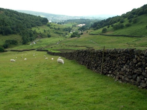
Paul Krugman Hits the Nail on the Head

NYC Zoning mapIn a Times piece called “Inequality and the City” about the competitive real estate markets in America’s affluent cities, Paul Krugman identifies the role that restrictive land use regulations continue to play in the chronic shortage of affordable housing:

But what about all the people, surely a large majority, who are being priced out of America’s urban revival? Does it have to be that way?

The answer, surely, is no, at least not to the extent we’re seeing now. Rising demand for urban living by the elite could be met largely by increasing supply. There’s still room to build, even in New York, especially upward. Yet while there is something of a building boom in the city, it’s far smaller than the soaring prices warrant, mainly because land use restrictions are in the way.

Exactly. Thank you. In the last five years, we seem to have gone from a time when no one was even cognizant of the role that zoning laws played in the chronic shortage of urban affordable housing, to the beginnings of a left-right consensus about the inequitable and anti-competitive impacts of those laws — and the ways in which they are distorting the market. This is really a cause for celebration, and I think we should take a moment to recognize how far the conversation has come.

But we almost certainly have not come to the end of the line. This issue has been so far beneath the radar that even those who have benefited from distortions of the real estate market by restrictive zoning laws have made little political effort to defend the status quo. They have just assumed that it would go on forever. Now, as those with vested interests in the artificial limits to development — primarily, urban land owners — begin to realize that their gravy train could be in peril, the attacks on reform proposals will begin in earnest. Here’s a great example of what’s likely to be on the way, peddling the usual pseudo-leftist bullshit that appeals to the urban bourgeoisie:

We, the undersigned residents of New York City, call for an end to the violence that real estate developers have inflicted on our skyline, parks, public areas, and cityscape with the proliferation of dramatically over-scaled buildings that ignore the historic context of our city.

Translation: we paid a lot for the exclusive right to live in our neighborhood. We have just realized how precarious our investment could become if the regulations were changed, and people actually had housing choices in the same (or comparable) locations.

Keep an eye out for more of this nonsense in the near future. Of course there’s a role for design and aesthetics in development policy, and massing considerations may sometimes be a part of that role. But for now, I’m sticking with those who recognize the need to permit much more residential construction in places like New York City. Let’s keep the conversation going.

Spotlight: New York’s City Hall

I took these pictures in October 2015, during a visit that I made to City Hall (1802-12), with Honey, as part of Open House New York. City Hall is located in New York’s historic town green — the topic of a previous LT post. My current office is at 250 Broadway, which is the glass building located just to the right of the Woolworth Building in a couple of the outdoor photos. More about the history and architecture of City Hall can be found here. Images of the Council Chamber, including its incredible ceiling, are at the end of the series.

Update: The Lost Public Baths of New York City

IMG_3278A few years ago, I wrote a short piece about the lost public baths of New York City. Built around the turn of the 20th century, the public baths were meant to address the lack of sufficient bathing facilities in areas with (1) high concentrations of old-law tenements and (2) no public beaches. They were concentrated on the east side of Manhattan.

This summer, I came across one of the bath buildings that still remains. Here’s a picture that I took on July 4th of the Free Public Baths at 23rd Street and the East River, which has now been converted into a public swimming pool. Still, the original inscription remains on the architrave:

FREE PUBLIC BATHS | CITY OF NEW YORK

The mix of tenements that once characterized the area — and which gave rise to the public baths — is long gone. The adjacent super-blocks are now occupied Peter Cooper Village (a formerly middle-income housing development) and the VA Hospital.

Here’s the structure, and its context, on Street View:

A Right to Counsel for Tenants

Mark Levine, a New York City Council member, has a bill in the hopper that would retain an attorney, at public expense, for low-income tenants facing eviction. In a Times op-ed authored by Levine and Mary Brosnahan of the Coalition for the Homeless, they cite some stark statistics:

▪ Only ten percent of tenants facing eviction in New York City have lawyers, while nearly 100 percent of evicting landlords are represented by counsel.

▪ Tenants represented by counsel are 80 percent less likely to be evicted than those acting pro se.

▪ Nearly 29,000 New York City households were evicted last year.

▪ Providing an attorney for a tenant would cost taxpayers about $2,500, but sheltering a homeless family in New York City costs, on average, more than $45,000.

New Jersey Real Estate Law Update

Scales and Lamp USSC

One New Jersey Supreme Court case, Cashin v. Bello, focused on a real estate matter this week. It was an unusually interesting case. The Star-Ledger explains:

The legal issue involves the grounds upon which a landlord can evict a tenant in order to occupy a home. Under New Jersey law, a landlord may evict a tenant from a building with three units or less if he or she intends to occupy the unit.

However, Cashin was prevented from evicting Bello for many years because she also owns an adjacent apartment building at 627 Washington Street with five rental units and both the apartment and the converted garage are listed in tax records as being part of the same property.

Bello has been living in the carriage house since 1973, and is paying just $345 per month under the Hoboken rent control law. Cashin — whose name seems apt in this case — has been trying to evict Bello since the 1980s. Now she can. The Supreme Court held that the lower courts had erred by treating the entire land parcel as a single building, containing more than three units, rather than treating the carriage house, alone, as a single, one-unit building. The temporary New Jersey Courts link is alive for now, but the original opinion will be archived next week at the Rutgers Law Library in Newark.

For your curiosity’s sake, here’s a look at the house:

Where Every Street is Named 60th

Kevin Walsh has a useful primer on the enigmatic pattern to Queens street numbering at Forgotten NY, and how it becomes all Sorcerer’s Apprentice in one section of Maspeth.

The 1920s decision to number almost every street in Queens is a great early example of a 20th-century planning initiative where ambition outstrips logic. I mean, if the various neighborhoods of Queens had simply been allowed to retain the street names that they’d had as the towns and cities that once composed the western portion of Queens County, Long Island, then their character would have been better preserved over the years; and people would have been no more lost in Queens than they are today. Moreover, new streets could have been added to these locales with their own unique names, deepening the character of these places.

Instead, we have this:

So communities, some of which date from the time of New Amsterdam, are robbed of an important part of their history to create a system that adds almost no logic or clarity to the layout of the modern city. The irony is that the one potential benefit of this grand attempt to ensure that no two places in the borough would share the same address might have been the establishment of a unified post office for the borough. Yet Queens remains the only New York City borough without a unified post office. So, for example, people there still have their mail addressed to Long Island City, Flushing, Jamaica, or Far Rockaway, rather than, simply, Queens, New York. The legacy of the old towns survives; just not in very many meaningful street names.

I’m inclined to think that a lot of these old street names will be recovered soon, especially in historic town centers, as real estate values increase and sellers want to highlight examples of local history and character.

Up Next: Self-Healing Concrete

Emily Matchar at Smithsonian.com has an article on the state of the art of self-healing concrete. The concept:

Inspired by the human body, Jonkers [the inventor], who works at the Delft University of Technology in the Netherlands, created self-healing concrete. He embeds the concrete with capsules of limestone-producing bacteria, either Bacillus pseudofirmus or Sporosarcina pasteurii, along with calcium lactate. When the concrete cracks, air and moisture trigger the bacteria to begin munching on the calcium lactate. They convert the calcium lactate to calcite, an ingredient in limestone, thus sealing off the cracks.

The article notes that the embedded bacteria can remain dormant in the material for more than 200 years. The current high price — about $40 per square meter — means that the material will likely be reserved for use in special situations, for the time being, such as underground and underwater structures. Meanwhile, Nwakibe Kanu at HAKSblog provides a somewhat broader survey of self-healing materials. He writes:

Other self-healing materials have built-in microcapsules filled with a glue-like chemical that can repair damage. If the material cracks, the capsules break, exposing the healing agent and sealing the crack. It is possible that such a mix will be viable on a large scale within the next five years.

This is all pretty awesome.

Venice, Urban Canals, and the Sea

GreatStreetsJacobsIn my free time, I’ve been reading Great Streets, the 1995 urban design art book, by Allan Jacobs — and a great birthday present from Honey :). Jacobs dedicates an entire chapter of Great Streets to Venice’s Grand Canal, making the case that certain cities’ urban canals are essentially liquid streets: as thoroughfares, places for public gathering, retail business, the showcasing of architecture, and cross-cutting neighborhood vistas.

Now, Google seems to have taken Jacobs’s position, offering extensive and striking StreetView images of the canals of Venice, treating them as the equivalent of city streets. Here’s a view of the Grand Canal, near the Rialto Bridge:

Here’s the Campanile di San Marco, seen from the water:

And here is a satellite view of the entire old city, surrounded by the Lagoon.

It’s fitting that the outline of Venice looks like a fish.

Now, in some ways, the canals of Venice are more than just technically streets. One could argue that in light of the role Venice played in the emergence of the modern commercial world the patterns of urbanization that developed there actually served as an early prototype for the growth of modern cities. The traffic flows in the city’s canals were not so different from those of land vehicles in modern or ancient cities. But the liquid nature of these streets presumably allowed for one less break of bulk between the arrival of goods in the city and their delivery to local end users — and this was good for the productive economy. In Roman Ostia, vast warehouses were used to store shipments of olive oil and wine amphorae that had been imported from Africa, Greece, and Spain. Each shipping company had its own branded warehouse, from which it sold goods to merchants one step down the supply chain, or stored them until its own distributors were ready to take them to market. Much smaller quantities were then transported, separately, up the Tiber to the city proper; or over land to other Italian cities and towns. This made for a supply chain with a lot of middle men, barriers to purchasing in bulk, and, presumably, high markups between the seaport and Roman workshops.

In Venice, the innovation would be that these points of delivery could be distributed throughout the city, rather than concentrated in a single seaport. In Venice, the urban fabric and the seaport became one, a development that predicted the more distributed pattern of industrial space in modern cities. Canals and their branches and slips would, of course, continue to be an important part of city-building for years to come, but only a few cities would have both the topography and trading frequency to justify the kind of extensive canal building that took place in Venice. Amsterdam comes to mind. More commonly, the post-Renaissance economy would interpret the lesson from Venice in another way: The most successful cities to be founded after the Renaissance would be those built on sites where natural waterways conveyed an almost Venetian advantage, and allowed for distributed delivery points. Think of New York City, with its miles and miles of natural waterfronts. Likewise, Hong Kong, San Francisco, and Sydney. Finally, the pattern of distributed industry would really be broken open, in the 19th century, by the railroads, which would slice through the fabric of every European and American town and city as thoroughly as the canals sliced through Venice.

Another interesting point is that Venice is also arguably more of a direct continuation of the Roman tradition than Byzantium was. That is to say, while the Eastern Empire may have carried on the apparatus of the Roman state from Constantinople until 1453, is was essentially a Greek cultural entity for its entire history; but Venice was founded in the fifth century by Italian Romans who had taken refuge from the fall of the Western Empire in an inaccessible Italian swamp, and who went on to preserve a slice of distinctly Latin culture — eventually building a city that carried on many parts of the Italian Roman tradition, and served as a unique cultural bridge between Late Antiquity and the Middle Ages and, ultimately, the Early Modern age. This is a simplification of Venetian history, but it illustrates the important thread. Because the plan of Venice — and especially its canals — more literally captures the tradition of Western commercial cities growing out of the sea, than almost any other example of European urbanism. From Ostia to Venice, and from Amsterdam to New Orleans, the mercantile tradition in the West has a long tradition of shaping a maritime urbanism in which the riches brought by sea trade have driven extensive urban growth on the land around the ports. And this growth has always been premised on the trading patterns of the merchants within the seaports.

The sea has always been a saturating element in trading cultures. Look at the Odyssey. Look at its haunting omnipresence in this Roman wall painting of Perseus and Andromeda, on view at the Metropolitan Museum, found in Boscotrecase, near Pompeii:

PerseusAndromeda

Perseus and Andromeda, from the Villa at Boscotrecase. Metropolitan Museum of Art.

Amidst its clear references to religion and fantasy, it is the sea, and not Vesuvius, which might consume all. I thought of this painting recently at work, where I’m writing decision letters for a post-Sandy recovery project here in New York City. Three years after that storm, the conflict between the city and the ocean is still being sorted out, block by block, house by house. Some people are selling their land back to the state; some are elevating their homes, with or without public subsidies; many are keeping their fingers crossed and going on as if nothing had happened in 2012.

The same forces of commerce, greed, politics, and ambition that built the world’s port cities are now driving the global climate change that threatens them. New Orleans was nearly wiped out in 2005; Venice now deals with flooding on a regular basis; in New York, Manhattan seems mostly oblivious, but the sprawling coastal neighborhoods of the outer boroughs are not looking very healthy. The paradox of mercantile cities, the wealth that they draw from maritime trade, and the ever-present danger of the sea, will not go away. It is only getting stronger.